Updated 2026 · 10 min · by NebulaTrip local experts
Mount Siguniang is not one trek. It is a managed scenic area with three visitor valleys, plus separately regulated outdoor routes whose status can change with fire prevention, ecology and weather. First-time visitors should choose Shuangqiao for the easiest high-mountain sightseeing, Changping for a flexible developed-valley walk, or Haizi only after matching the route to altitude and current access. Do not revive an old Changping–Bipenggou crossing itinerary from a blog: in 2026 the authorities are actively distinguishing named open activities from undeveloped or unopened protected areas.
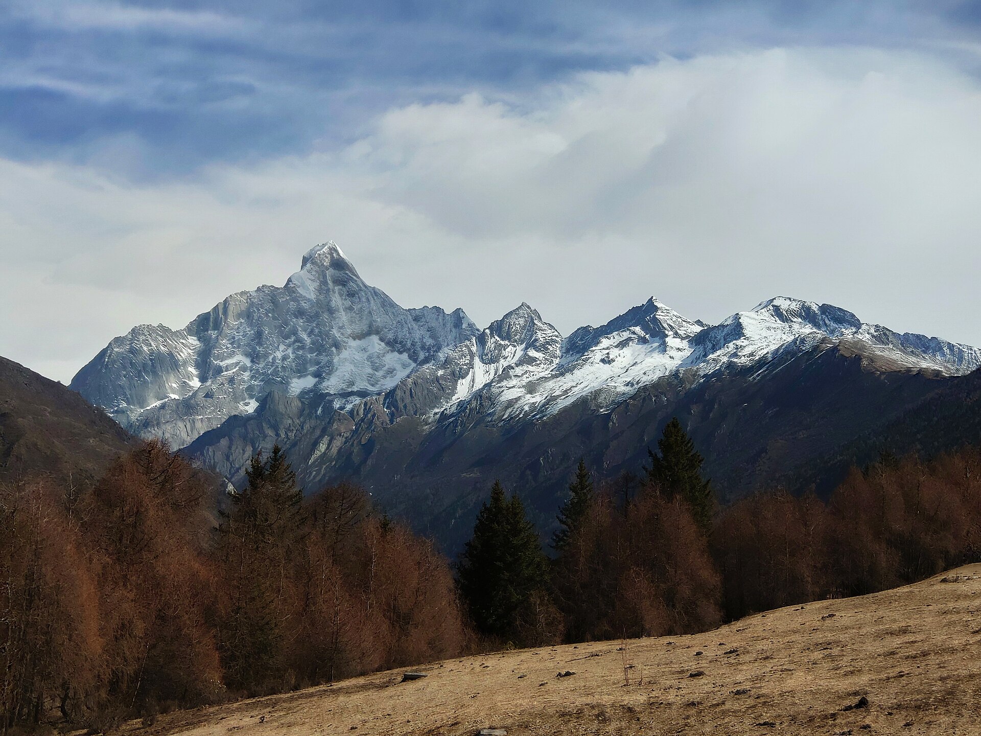
For one day, choose Shuangqiao. The official scenic-area material describes it as the most comfortable self-guided valley, using sightseeing vehicles and designated stops; short walks can be added without pretending it is a wilderness trek. For two days, add a controlled section of Changping after seeing how the group sleeps and walks at altitude. Three days creates a useful arrival or recovery day and allows Haizi to become a considered option.
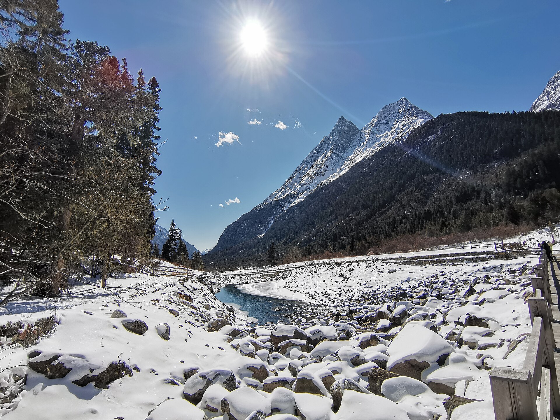
The three entrances and transport systems are not interchangeable. A Shuangqiao ticket does not grant access to every trail, and a photograph from Changping does not describe Haizi conditions. As of April 2026 the published entry cutoff was 15:00 for Shuangqiao and 14:30 for Changping and Haizi, subject to later notices. Those are last-entry times, not suggested hiking starts; a long walking day begins much earlier.
Use Siguniangshan Town as the base and confirm which visitor centre the driver means. The older name Rilong still appears in historic itineraries, but it should not be the only destination instruction. Spend the arrival afternoon lightly instead of going straight from the Sichuan Basin into a hard climb.
Shuangqiao: use the park vehicle to reach the upper valley, then walk selected boardwalk or path sections rather than sitting on every transfer. It is the sensible choice for mixed mobility, a first altitude day or uncertain weather. “Developed” does not mean step-free everywhere; ask the visitor centre which stops suit the group.
Changping: combine the scenic-area transfer with an out-and-back walk on the designated visitor route. Forest, water, pasture and views toward the massif appear gradually, so decide a turnaround time rather than attaching the walk to a distant place name. Horse services, if operating, reduce walking but do not remove altitude, weather or trail exposure; confirm the official boarding point and terms.
Haizi: this is the more demanding walking choice. The name covers a valley and multiple outdoor objectives, not one uniform day hike. In April 2026 the authority reopened only some Haizi outdoor routes and required clubs or companies to follow the outdoor-management rules. Ordinary scenic-area admission should not be assumed to authorise camping, a summit approach or a remote lake itinerary. Ask for the exact open endpoint and registration category.
On 22 May 2026, Xiaojin County and the reserve administration prohibited organisations and individuals from entering undeveloped or unopened areas for hiking, climbing, camping, crossings and other activities. The notice also states that unauthorised entry may bring legal consequences and rescue costs. It applies even when an old GPS line, animal trail or social post makes the terrain look reachable.
That makes the familiar Changping–Bipenggou crossing a route that requires fresh, route-specific proof, not a standard add-on for a guide to arrange informally. Ask the outdoor activity centre or an authorised operator whether the full named crossing is open on the dates, what registration is required, which company is responsible, and where the approved route begins and ends. “We have a local guide” is not an opening notice.
Even an open outdoor line can close for forest-fire controls, events, restoration or dangerous weather. Save the current official notice, emergency number and registered itinerary offline. Do not leave an open route to create a shortcut, camp outside the approved plan or pressure staff to honour a booking after a closure.
The base town and valley routes place visitors at genuine high altitude, and a rapid road ascent from Chengdu does not provide meaningful acclimatisation. A fit runner can still develop acute mountain sickness. Use Shuangqiao or a light town day first, sleep before committing to a harder route, and keep the first uphill pace deliberately slow.
Headache after ascent with nausea, dizziness or unusual fatigue can indicate acute mountain sickness. Do not go higher while symptoms persist. If symptoms worsen at the same height, descend and seek help. Confusion, inability to walk straight or breathlessness at rest are emergencies. Normal hydration prevents dehydration but does not immunise anyone against altitude illness; portable oxygen is not a substitute for descent in a serious case.
For an approved walking route, carry broken-in footwear, poles, waterproof outerwear, warm layers, sun protection, headlamp, food, water, an offline map and a power bank. Turnaround time is chosen before the group is exhausted. A horse, park vehicle or shorter walk is a valid adjustment, but a sick traveller should not be moved to a higher sleeping altitude because transport makes it easy.
Road travel from Chengdu is a substantial mountain transfer. Route and duration vary with traffic, works and weather, so avoid an irrevocable flight or train immediately after the return. Book accommodation in Siguniangshan Town for the actual valley entrance and confirm heating, hot water, breakfast time and luggage storage rather than assuming every mountain guesthouse is equally equipped.
Late spring, summer, autumn and winter bring different vegetation and trail problems, but no month guarantees clear peaks, flowers, golden forest or snow. Check the official weather, fire-prevention and opening notices immediately before travel. Pack sun and rain protection in the same bag and expect a sharp temperature drop after cloud or sunset.
A guide is useful when they identify the exact authorised route, complete outdoor registration, set conservative altitude and weather limits, and refuse an illegal shortcut. They are not useful merely because they promise access. For developed valley sightseeing, an independent traveller can use official tickets and vehicles; for any climbing, camping or crossing, use the current regulated process and a properly responsible operator. Respect religious structures and local residents, ask before close photographs, and carry every piece of rubbish back out.
Book the Siguniang Mountain Changping-Bipenggou Crossing with real-time availability.
See tour & book Plan with AIPrivate & flexible · English-speaking guide · real-time online booking.
Tell our local experts what you'd like to see and we'll design a private, tailor-made itinerary with English-speaking guides — free plan & quote, no obligation.